Seznam souborů
Tato speciální stránka zobrazuje všechny načtené soubory.
| Datum | Název | Náhled | Velikost (bajtů) | Uživatel | Popis | Verze |
|---|---|---|---|---|---|---|
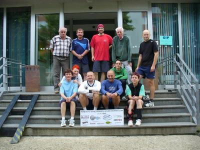
| 5. 6. 2009, 10:22 | Gk2009-oldies-400px.jpg (soubor) |  |
55 KB | Soucek | Složení družstva Oldies na turnaji GK2009 | 1 |
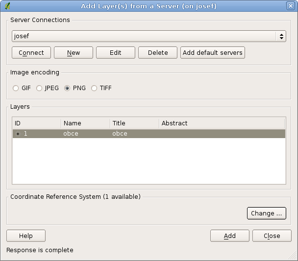
| 30. 4. 2009, 08:46 | Qgis-wms3.png (soubor) |  |
27 KB | Landa | Výběr vrstvy WMS serveru v QGISu {{GFOSS}} | 1 |
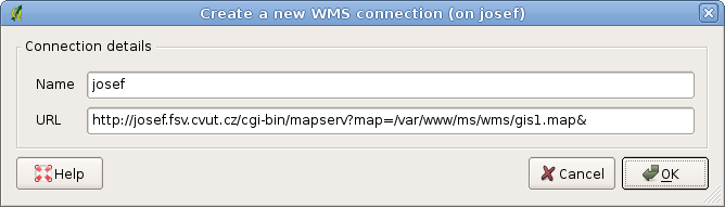
| 30. 4. 2009, 08:46 | Qgis-wms2.png (soubor) |  |
17 KB | Landa | Připojení k WMS serveru na josefovi v QGISu {{GFOSS}} | 1 |
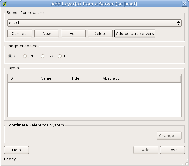
| 30. 4. 2009, 08:45 | Qgis-wms1.png (soubor) |  |
25 KB | Landa | Nastavení připojení k WMS serveru v QGISu {{GFOSS}} | 1 |
| 29. 4. 2009, 07:07 | Mapserver-logo.png (soubor) | 41 KB | Landa | UMN MapServer logo {{GFOSS}} | 1 | |
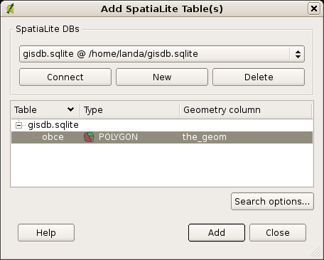
| 22. 4. 2009, 11:58 | Qgis-spatialite-2.png (soubor) |  |
17 KB | Landa | Přidání SpatiaLite vrstvy v QGISu (2) {{GFOSS}} | 1 |
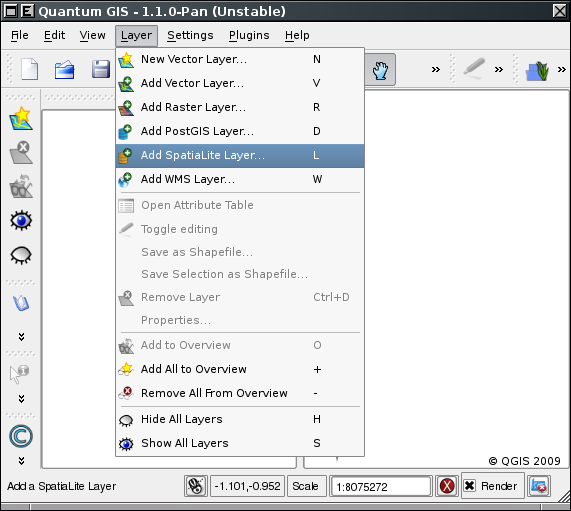
| 22. 4. 2009, 08:07 | Qgis-spatialite.png (soubor) |  |
54 KB | Landa | Přidání SpatiaLite vrstvy v QGISu {{GFOSS}} | 1 |
| 21. 4. 2009, 20:40 | Spatialite-logo.png (soubor) | 56 KB | Landa | Logo SpatiaLite | 1 | |
| 21. 4. 2009, 20:39 | Sqlite-logo.png (soubor) | 3 KB | Landa | Logo SQLite | 1 | |
| 20. 4. 2009, 10:45 | Emacs sql.png (soubor) |  |
33 KB | Landa | Emacs a psql {{GNU}} | 1 |
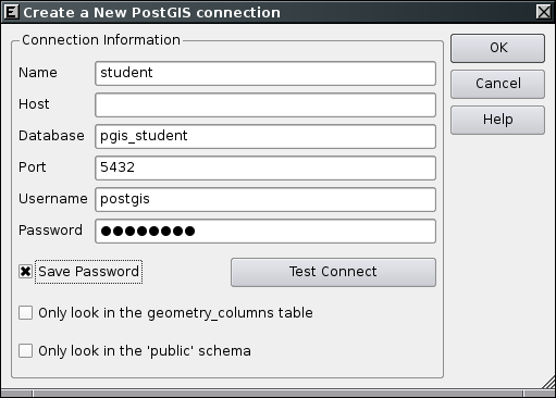
| 16. 4. 2009, 15:56 | Qgis-pgis1.png (soubor) |  |
22 KB | Landa | Nastavení připojení k databázi pgis_student v QGISu {{GIS}} {{GFOSS}} | 1 |
| 31. 3. 2009, 07:39 | Gdal-logo.png (soubor) | 68 KB | Landa | GDAL logo {{GIS}} | 1 | |
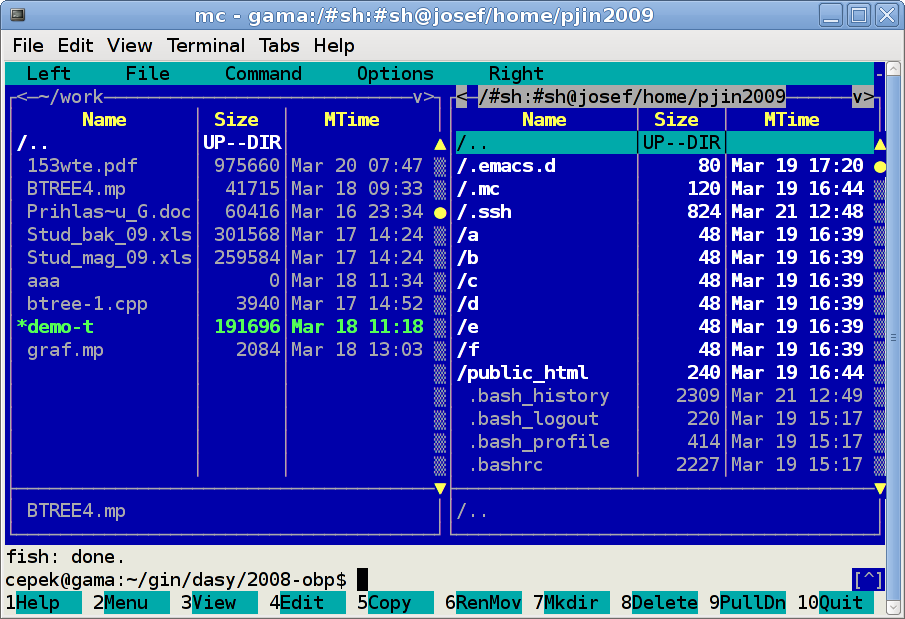
| 21. 3. 2009, 11:56 | Mc-shell-link.png (soubor) |  |
126 KB | Cepek | Ukázka mc s připojením na jiný počítač přes shell link | 1 |
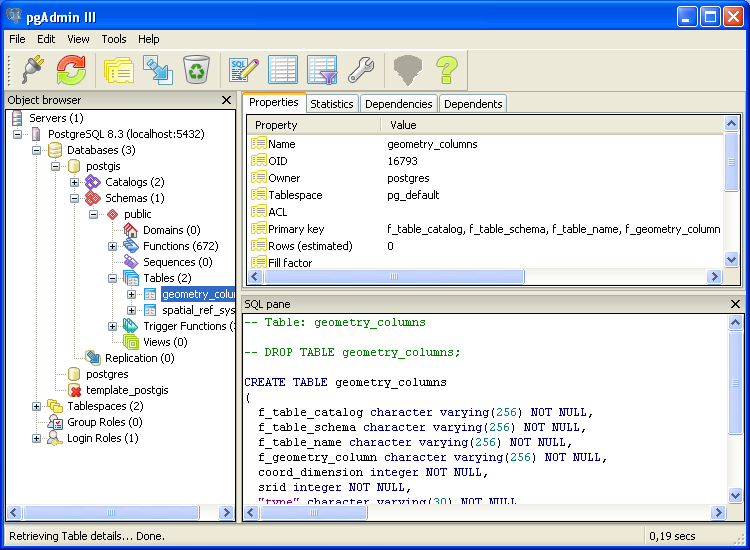
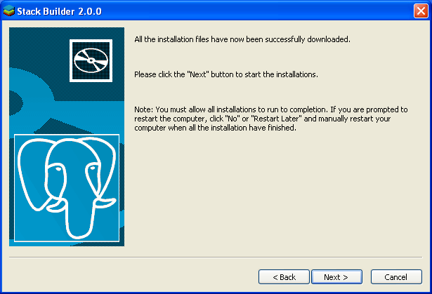
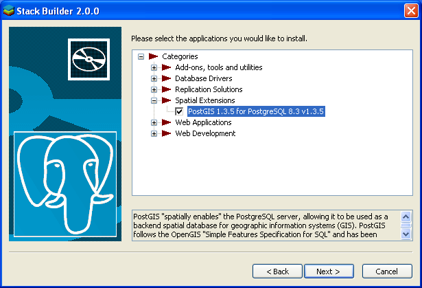
| 14. 3. 2009, 21:49 | Pgadmin-postgis.png (soubor) |  |
53 KB | Landa | pgadmin MS Windows | 1 |
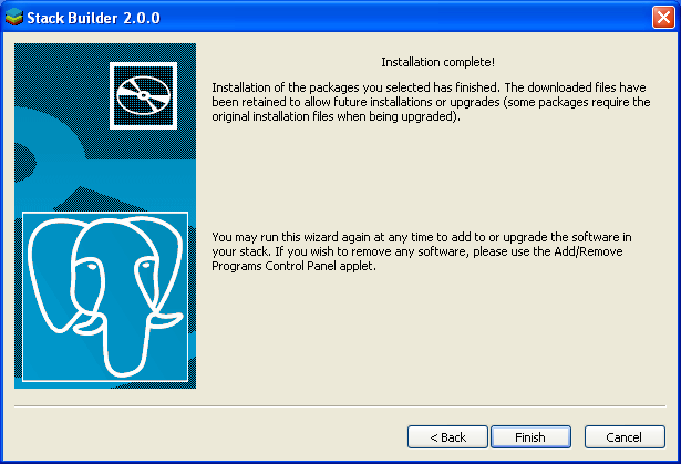
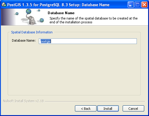
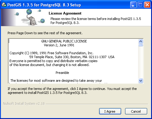
| 14. 3. 2009, 21:45 | Postgis12.png (soubor) |  |
23 KB | Landa | Instalace PostGIS - krok 12 | 1 |
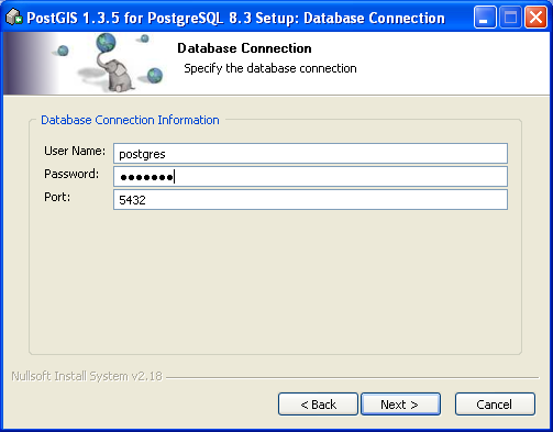
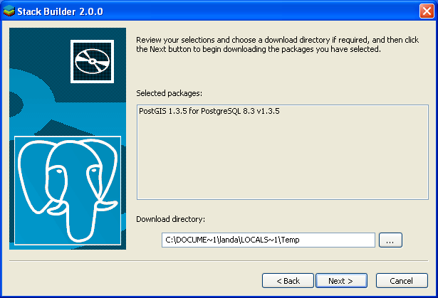
| 14. 3. 2009, 21:45 | Postgis11.png (soubor) |  |
20 KB | Landa | Instalace PostGIS - krok 11 | 1 |
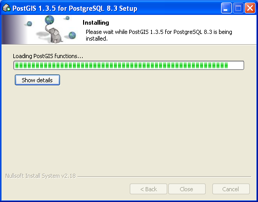
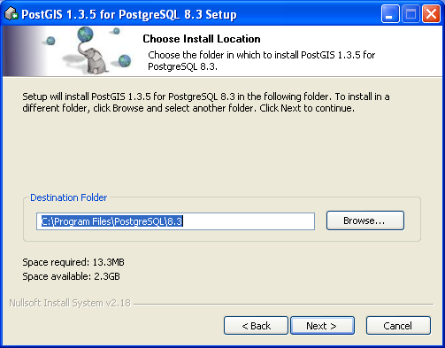
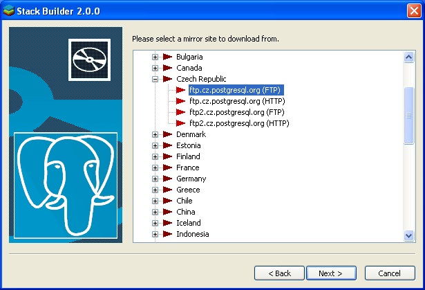
| 14. 3. 2009, 21:44 | Postgis10.png (soubor) |  |
21 KB | Landa | Instalace PostGIS - krok 10 | 1 |
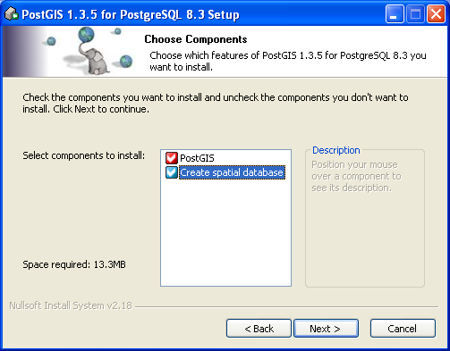
| 14. 3. 2009, 21:44 | Postgis9.png (soubor) |  |
21 KB | Landa | Instalace PostGIS - krok 9 | 1 |
| 14. 3. 2009, 21:44 | Postgis8.png (soubor) |  |
23 KB | Landa | Instalace PostGIS - krok 8 | 1 |
| 14. 3. 2009, 21:44 | Postgis7.png (soubor) |  |
24 KB | Landa | Instalace PostGIS - krok 7 | 1 |
| 14. 3. 2009, 21:43 | Postgis6.png (soubor) |  |
25 KB | Landa | Instalace PostGIS - krok 6 | 1 |
| 14. 3. 2009, 21:43 | Postgis5.png (soubor) |  |
22 KB | Landa | Instalace PostGIS - krok 5 | 1 |
| 14. 3. 2009, 21:43 | Postgis4.png (soubor) |  |
23 KB | Landa | Instalace PostGIS - krok 4 | 1 |
| 14. 3. 2009, 21:42 | Postgis3.png (soubor) |  |
27 KB | Landa | Instalace PostGIS - krok 3 | 1 |
| 14. 3. 2009, 21:42 | Postgis2.png (soubor) |  |
26 KB | Landa | Instalace PostGIS - krok 2 | 1 |
| 14. 3. 2009, 21:41 | Postgis1.png (soubor) |  |
24 KB | Landa | Instalace PostGIS - krok 1 | 1 |
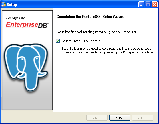
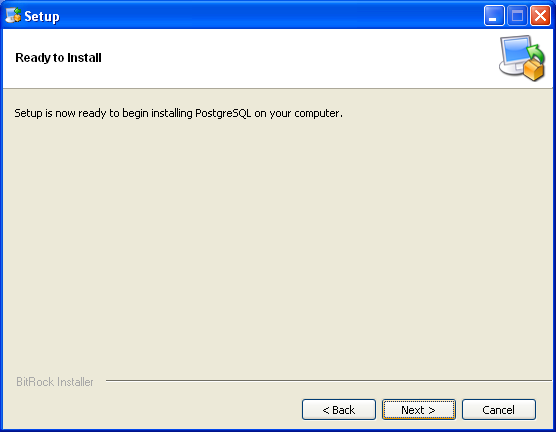
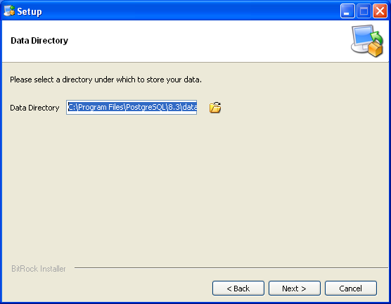
| 14. 3. 2009, 21:33 | Postgresql9.png (soubor) |  |
47 KB | Landa | Instalace PostgreSQL - krok 9 | 1 |
| 14. 3. 2009, 21:33 | Postgresql8.png (soubor) |  |
15 KB | Landa | Instalace PostgreSQL - krok 8 | 1 |
| 14. 3. 2009, 21:33 | Postgresql7.png (soubor) |  |
15 KB | Landa | Instalace PostgreSQL - krok 7 | 1 |
| 14. 3. 2009, 21:33 | Postgresql6.png (soubor) |  |
15 KB | Landa | Instalace PostgreSQL - krok 6 | 1 |
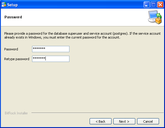
| 14. 3. 2009, 21:33 | Postgresql5.png (soubor) |  |
14 KB | Landa | Instalace PostgreSQL - krok 5 | 1 |
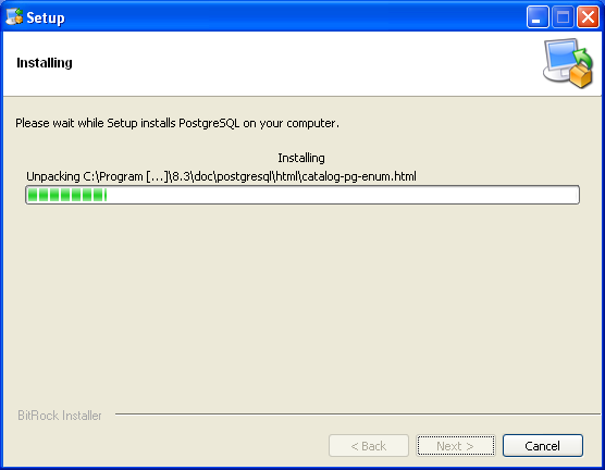
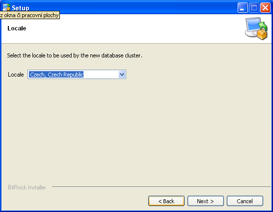
| 14. 3. 2009, 21:32 | Postgresql4.png (soubor) |  |
15 KB | Landa | Instalace PostgreSQL - krok 4 | 1 |
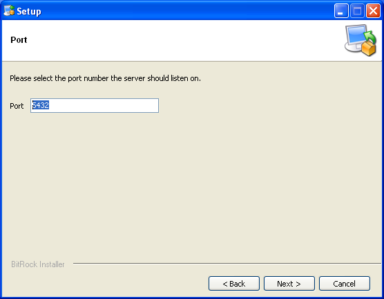
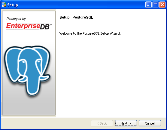
| 14. 3. 2009, 21:32 | Postgresql3.png (soubor) |  |
15 KB | Landa | Instalace PostgreSQL - krok 1 | 1 |
| 14. 3. 2009, 21:32 | Postgresql2.png (soubor) |  |
16 KB | Landa | Instalace PostgreSQL - krok 2 | 1 |
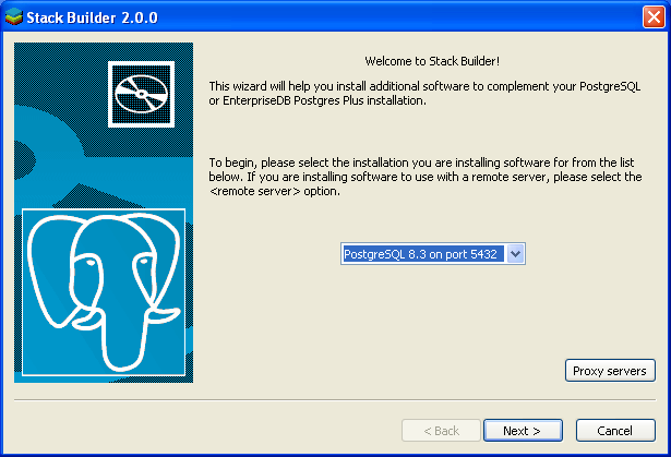
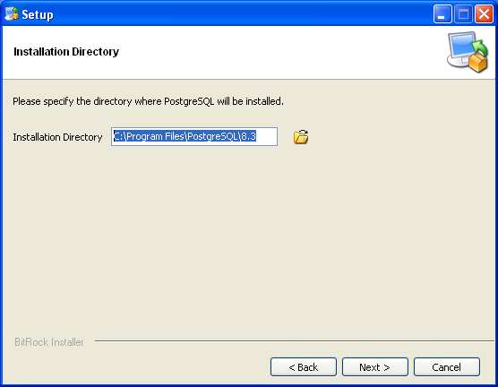
| 14. 3. 2009, 21:32 | Postgresql1.png (soubor) |  |
45 KB | Landa | Instalace PostgreSQL - krok 1 | 1 |
| 12. 3. 2009, 10:54 | Postgis.png (soubor) |  |
14 KB | Landa | PostGIS logo {{GIS}} | 1 |
| 11. 3. 2009, 10:39 | Osm-fsv.png (soubor) |  |
315 KB | Landa | OpenStreetMap {{Kartografie}} | 1 |
| 13. 1. 2009, 22:07 | Grass-net-spath.png (soubor) |  |
41 KB | Landa | Nejkratší cesta od vybraných požárních stanic k ohnisku požáru {{GRASS}} | 1 |
| 12. 1. 2009, 16:54 | Grass-streets-path-3d.png (soubor) |  |
192 KB | Landa | Vizualizace rastrové vrstvy nákladů ve 3D {{GIS}} | 1 |
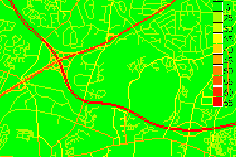
| 12. 1. 2009, 16:45 | Grass-streets-path.png (soubor) |  |
37 KB | Landa | Výsledek, nejkratší cesta k požáru {{GIS}} | 1 |
| 12. 1. 2009, 16:02 | Grass-streets-cost.png (soubor) |  |
286 KB | Landa | Analýza nákladů pohybu v terénu, ohnisko požáru + požární stanice {{GIS}} | 1 |
| 12. 1. 2009, 15:06 | Grass-streets-speed.png (soubor) |  |
20 KB | Landa | Rasterizovaná síť silnic s parametrem dovolené rychlosti {{GIS}} | 1 |
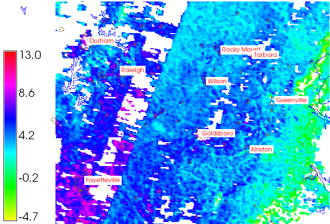
| 5. 1. 2009, 21:26 | ZOD-cv12-prumerna-teplota-zari-filtr.png (soubor) |  |
100 KB | Landa | Průměrná teplota povrchu září 2002 (odfiltrovány místa s nízkým počtem validních pixelů {{ZOD}} | 1 |
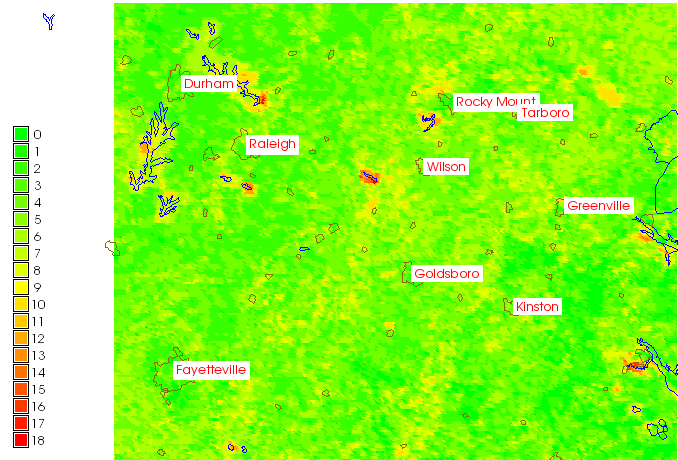
| 5. 1. 2009, 21:21 | ZOD-cv12-prumerna-teplota-zari-pocet.png (soubor) |  |
67 KB | Landa | Počet validních pixelů (not NULL) {{ZOD}} | 1 |
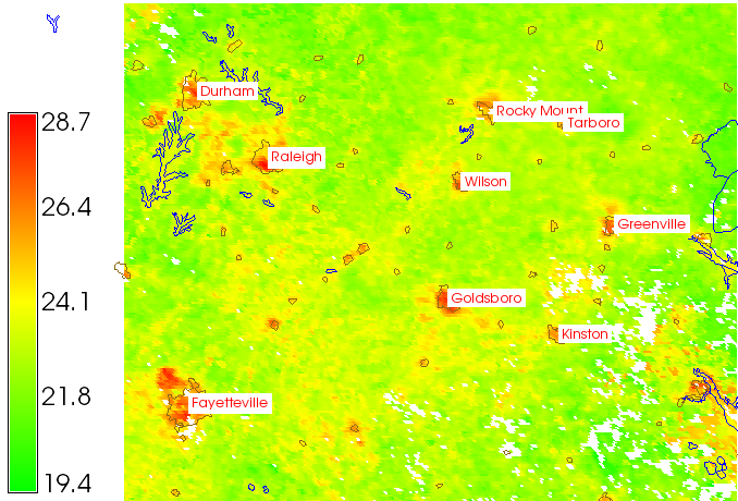
| 5. 1. 2009, 21:18 | ZOD-cv12-prumerna-teplota-zari.png (soubor) |  |
167 KB | Landa | Průměrná teplota povrchu září 2002 {{ZOD}} | 1 |
| 5. 1. 2009, 21:06 | ZOD-cv12-terra-diff.png (soubor) |  |
161 KB | Landa | Rozdíl teplot povrchu ZOD | 1 |
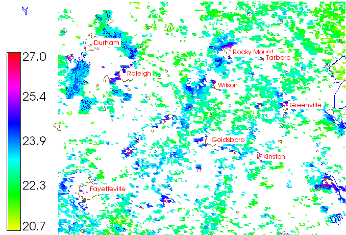
| 5. 1. 2009, 21:04 | ZOD-cv12-terra-second.png (soubor) |  |
101 KB | Landa | Teplota povrhu - 22.09.02, noc 22:30h, terra_lst_night20020922 {{ZOD}} | 1 |
| 5. 1. 2009, 21:03 | ZOD-cv12-terra-first.png (soubor) |  |
152 KB | Landa | Teplota povrchu - noc 22:30h, terra_lst_night20020921 (bílá místa představují odfiltrované mraky) {{ZOD}} | 1 |
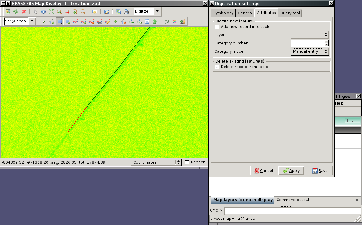
| 2. 12. 2008, 20:03 | ZOD-cv8-wxdigit.png (soubor) |  |
395 KB | Landa | Zpracování obrazových dat - digitalizace {{Zpracování obrazových dat}} | 1 |
| 25. 11. 2008, 16:59 | Cepicky-webgis.pdf (soubor) | 3,71 MB | Landa | Free Software GIS, prednaska, Jachym Cepicky | 1 |