Seznam souborů
Tato speciální stránka zobrazuje všechny načtené soubory.
| Datum | Název | Náhled | Velikost (bajtů) | Uživatel | Popis | Verze |
|---|---|---|---|---|---|---|
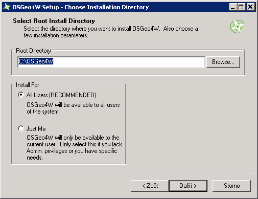
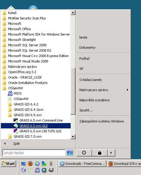
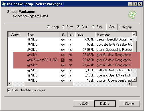
| 5. 10. 2012, 07:09 | Osgeo4w-dev-2.png (soubor) |  |
8 KB | Landa | Instalace vývojové verze GRASS pomocí OSGeo4W {{GFOSS}} | 1 |
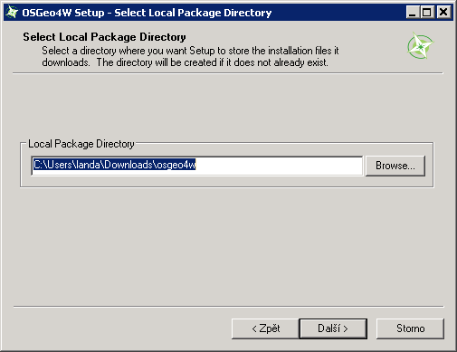
| 5. 10. 2012, 07:09 | Osgeo4w-dev-3.png (soubor) |  |
7 KB | Landa | Instalace vývojové verze GRASS pomocí OSGeo4W {{GFOSS}} | 1 |
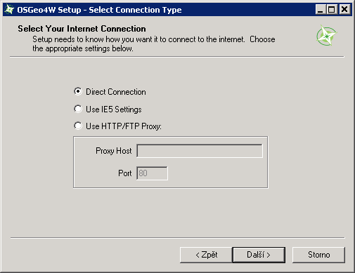
| 5. 10. 2012, 07:10 | Osgeo4w-dev-4.png (soubor) |  |
7 KB | Landa | Instalace vývojové verze GRASS pomocí OSGeo4W {{GFOSS}} | 1 |
| 5. 10. 2012, 07:10 | Osgeo4w-dev-6.png (soubor) |  |
6 KB | Landa | Instalace vývojové verze GRASS pomocí OSGeo4W {{GFOSS}} | 1 |
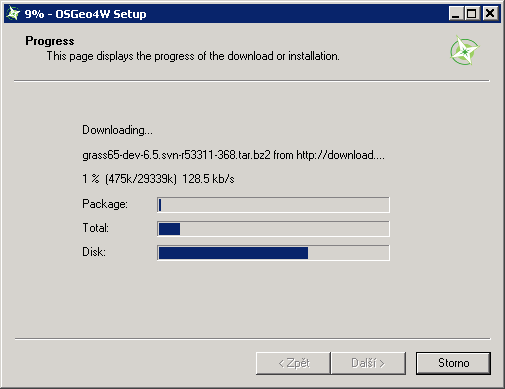
| 5. 10. 2012, 07:10 | Osgeo4w-dev-7.png (soubor) |  |
23 KB | Landa | Instalace vývojové verze GRASS pomocí OSGeo4W {{GFOSS}} | 1 |
| 5. 10. 2012, 07:14 | Osgeo4w-dev-5.png (soubor) |  |
11 KB | Landa | 1 | |
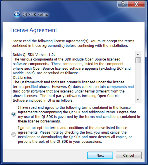
| 18. 10. 2012, 06:58 | Qt-msvc2010-img10.png (soubor) |  |
142 KB | Cepek | 1 | |
| 18. 10. 2012, 07:06 | Qt-msvc2010-img09.png (soubor) |  |
162 KB | Cepek | 1 | |
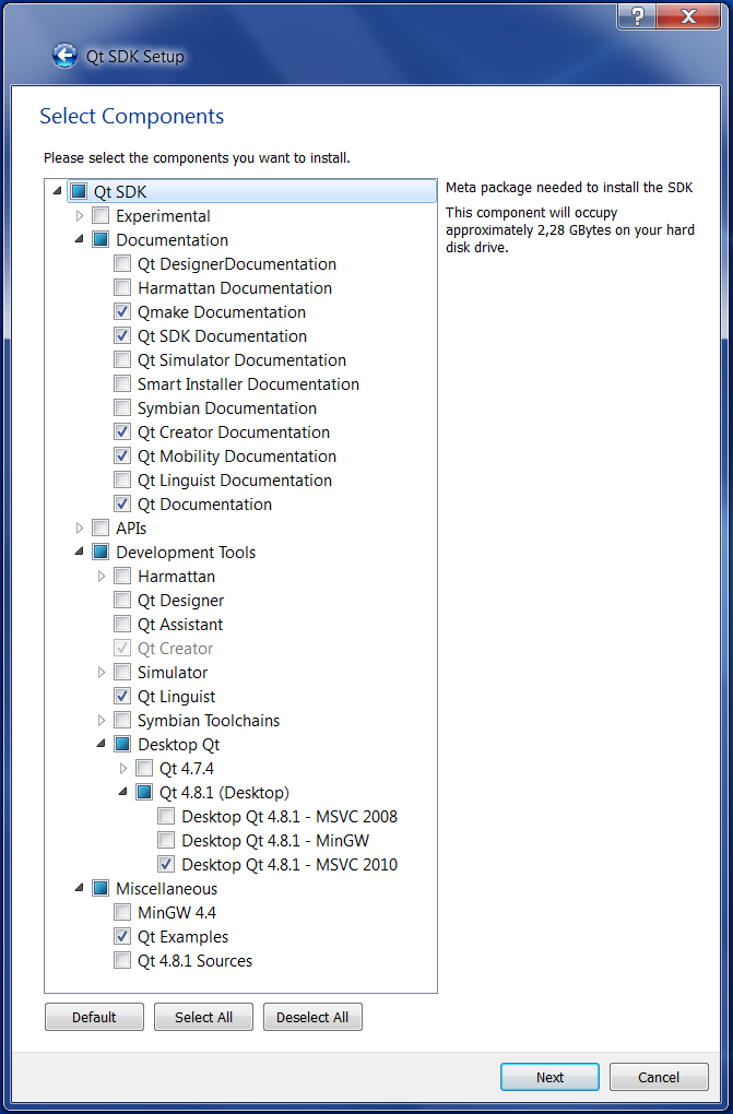
| 18. 10. 2012, 07:09 | Qt-msvc2010-img08.png (soubor) |  |
42 KB | Cepek | 1 | |
| 18. 10. 2012, 07:09 | Qt-msvc2010-img07.png (soubor) |  |
45 KB | Cepek | 1 | |
| 18. 10. 2012, 07:09 | Qt-msvc2010-img06.png (soubor) |  |
43 KB | Cepek | 1 | |
| 18. 10. 2012, 07:10 | Qt-msvc2010-img05.png (soubor) |  |
46 KB | Cepek | 1 | |
| 18. 10. 2012, 07:10 | Qt-msvc2010-img04.png (soubor) |  |
61 KB | Cepek | 1 | |
| 18. 10. 2012, 07:10 | Qt-msvc2010-img03.png (soubor) |  |
96 KB | Cepek | 1 | |
| 18. 10. 2012, 07:11 | Qt-msvc2010-img02.png (soubor) |  |
45 KB | Cepek | 1 | |
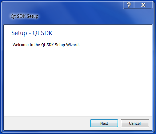
| 18. 10. 2012, 07:11 | Qt-msvc2010-img01.png (soubor) |  |
36 KB | Cepek | 1 | |
| 26. 10. 2012, 05:56 | Soukup.petr.jpg (soubor) |  |
18 KB | Soukup | 3 | |
| 31. 10. 2012, 09:57 | Wxgui-legenda.png (soubor) | 16 KB | Landa | Zobrazení legendy ve wxGUI {{GRASS}}} | 1 | |
| 16. 11. 2012, 14:57 | Grass-surf-temp.png (soubor) |  |
328 KB | Landa | Příklad výsledné rastrové mapy teplotní analýzy {{GRASS}} | 1 |
| 16. 11. 2012, 15:08 | Grass-save-display.png (soubor) | 14 KB | Landa | Uložit obsah mapového okna jako obrázek {{GRASS}} | 1 | |
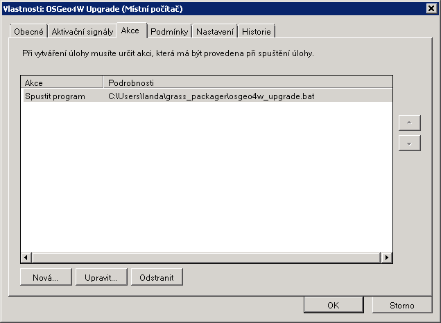
| 21. 11. 2012, 21:25 | Osgeo4w-cronjob-0.png (soubor) |  |
9 KB | Landa | OSGeo4W plánovač úloh {{GRASS}} | 1 |
| 21. 11. 2012, 21:25 | Osgeo4w-cronjob-1.png (soubor) |  |
5 KB | Landa | OSGeo4W plánovač úloh {{GRASS}} | 1 |
| 21. 11. 2012, 21:25 | Osgeo4w-cronjob-2.png (soubor) |  |
6 KB | Landa | OSGeo4W plánovač úloh {{GRASS}} | 1 |
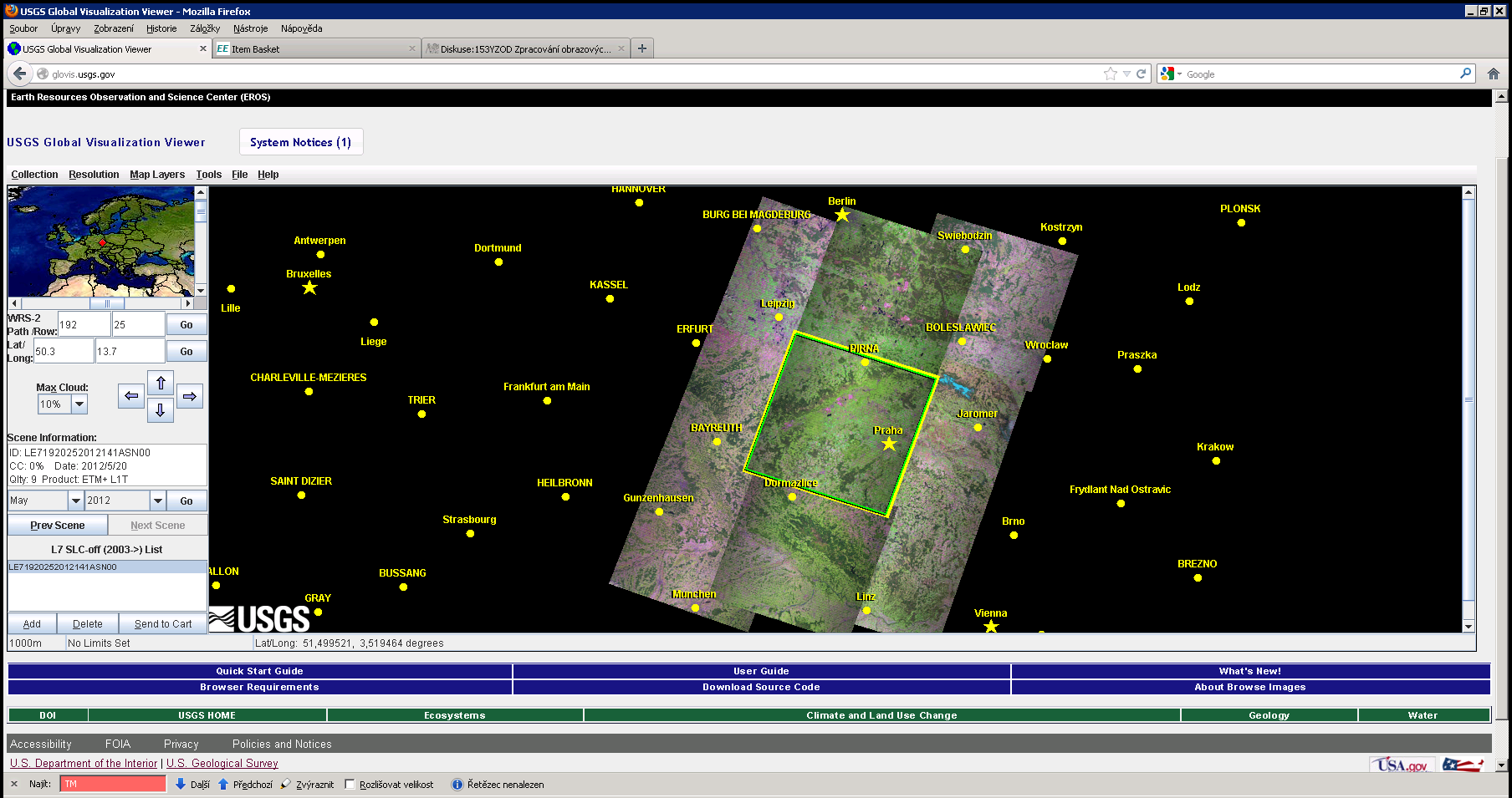
| 30. 11. 2012, 12:44 | Landsat-download-tm.png (soubor) |  |
438 KB | Landa | 1 | |
| 5. 12. 2012, 18:05 | Frvs gnss.jpg (soubor) |  |
21 KB | Cajthaml | 1 | |
| 5. 12. 2012, 18:06 | Frvs ts.jpg (soubor) |  |
169 KB | Cajthaml | 1 | |
| 5. 12. 2012, 18:06 | Frvs zeno.jpg (soubor) |  |
204 KB | Cajthaml | 1 | |
| 5. 12. 2012, 20:46 | Frvs pentax.jpg (soubor) |  |
159 KB | Cajthaml | 1 | |
| 11. 12. 2012, 13:10 | Gsoc-logo.png (soubor) | 45 KB | Landa | 3 | ||
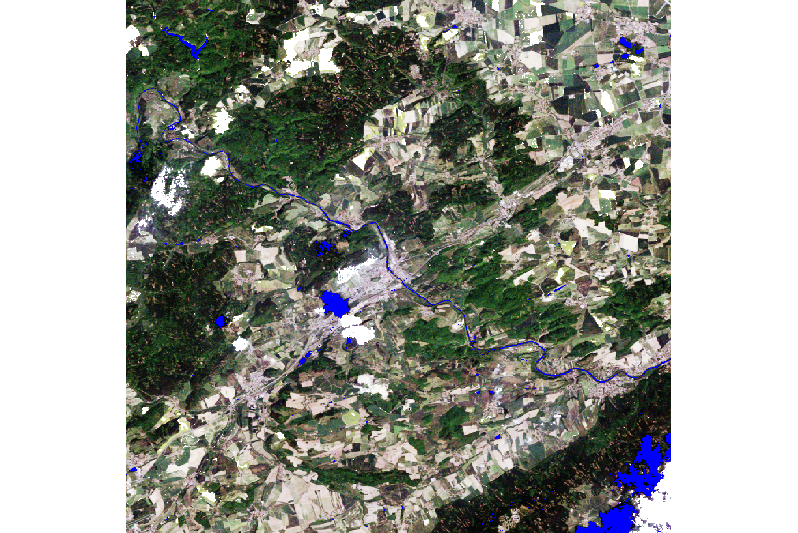
| 15. 12. 2012, 10:50 | Zodh-grass-detekce-hran.png (soubor) |  |
236 KB | Landa | Detail města, barevná syntéza ve skutečných barvách a ztenčené hrany {{GRASS}} | 1 |
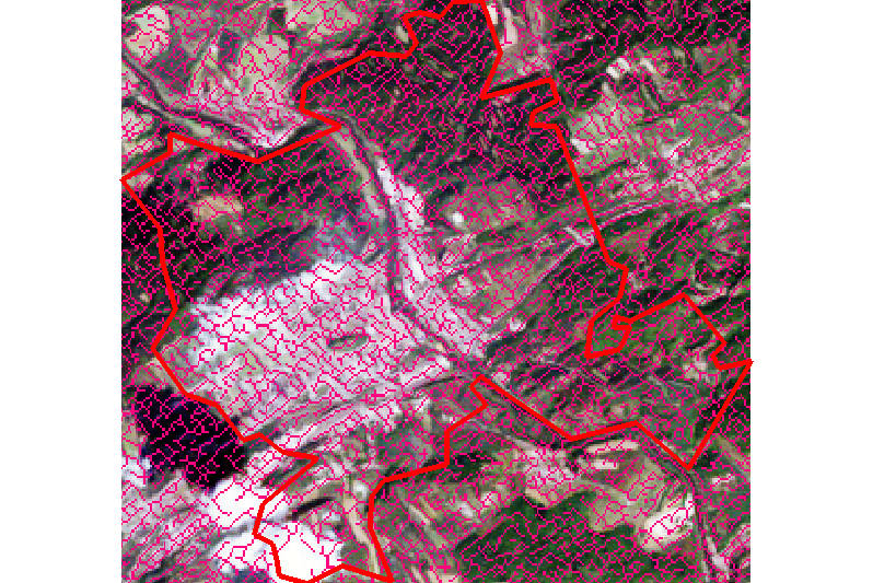
| 15. 12. 2012, 11:03 | Zodh-grass-prahovani.png (soubor) |  |
660 KB | Landa | Výpočetní region, barevná syntéza ve skutečných barvách s nastavenou maskou {{GRASS}} | 1 |
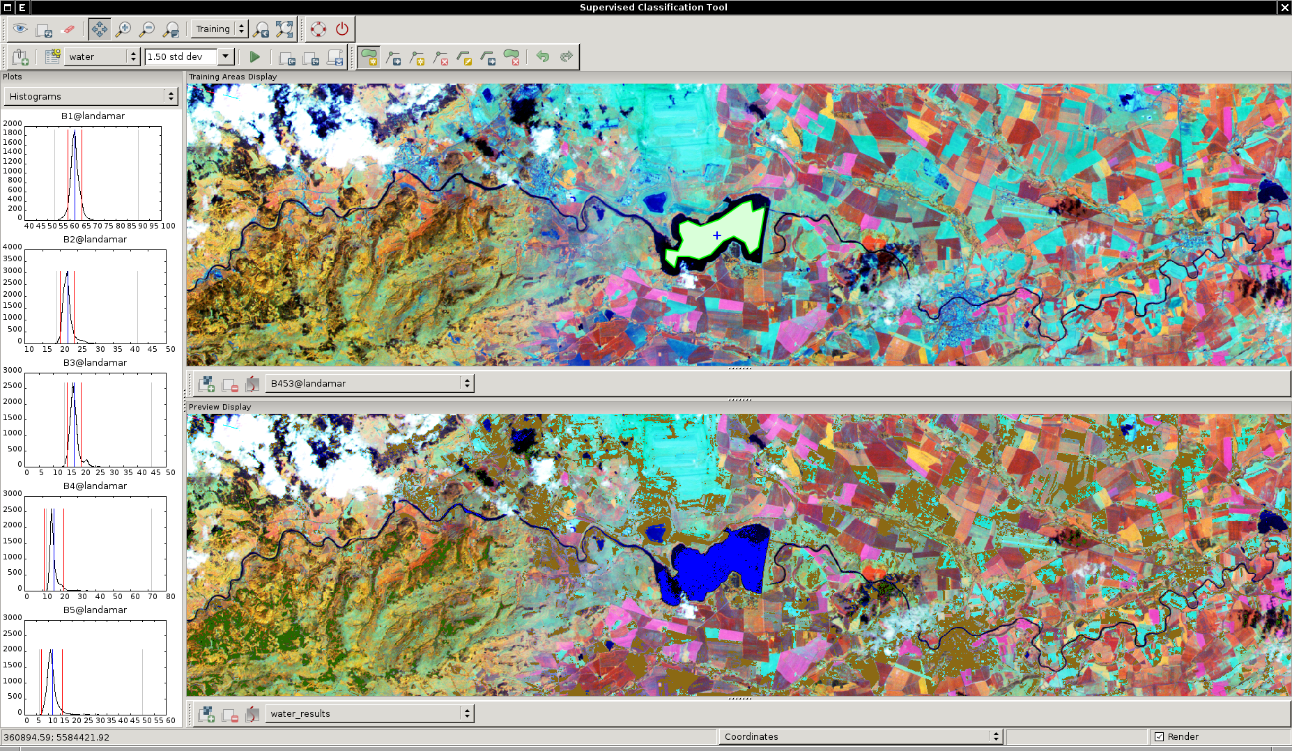
| 18. 12. 2012, 18:01 | Wxgui-iclass.png (soubor) |  |
1,85 MB | Landa | wxGUI Supervised Classification Tool {{GRASS}} | 1 |
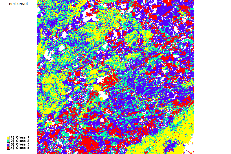
| 2. 1. 2013, 09:40 | Grass-nerizena4.png (soubor) |  |
122 KB | Landa | Příklad výstupu pro neřízenou klasifikaci {{GRASS}} | 1 |
| 11. 1. 2013, 12:55 | Gizela.sit.test.png (soubor) |  |
80 KB | Kubin | 1 | |
| 3. 2. 2013, 14:18 | Janata.png (soubor) |  |
5 KB | JanataT | 1 | |
| 19. 2. 2013, 14:24 | Qgis-postgis-icon.png (soubor) | 1 KB | Landa | QGIS PostGIS icon {{GFOSS}} | 1 | |
| 19. 2. 2013, 14:30 | Qgis-postgis-toolbar.png (soubor) | 51 KB | Landa | Podpora PostGIS v prostředí QGISu {{GFOSS}} | 1 | |
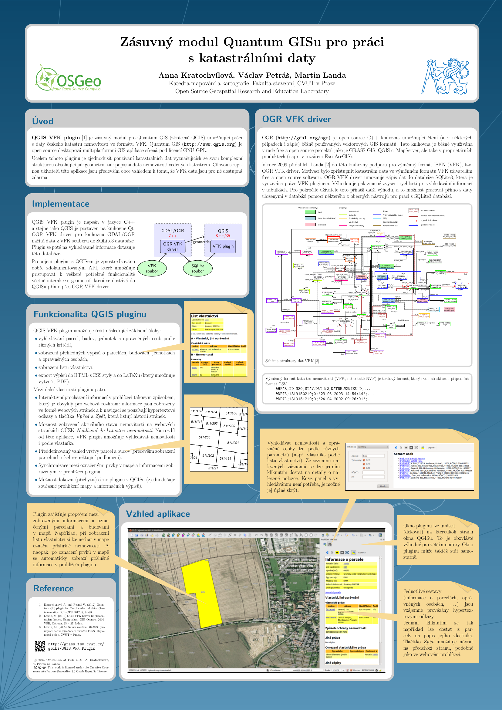
| 9. 3. 2013, 16:56 | Landa-ogrs2012-poster.png (soubor) |  |
1,56 MB | Landa | Landa: OGRS2012 poster | 1 |
| 9. 3. 2013, 17:11 | Kratochvilova-gisostrava2013-poster.png (soubor) |  |
1,44 MB | Landa | Kratochvilova GIS Ostrava 2013 poster | 1 |
| 23. 3. 2013, 17:57 | Volejbal-gk2013-plakat-170px.jpg (soubor) |  |
12 KB | Soucek | Plakát GK2013 | 1 |
| 13. 6. 2013, 19:11 | Martin Landa.jpg (soubor) |  |
490 KB | Landa | 2 | |
| 16. 9. 2013, 15:01 | GISday13-banner.jpg (soubor) |  |
12 KB | Muller | gis day banner | 1 |
| 29. 9. 2013, 07:57 | Gk-logo.png (soubor) | 8 KB | Landa | Logo | 1 | |
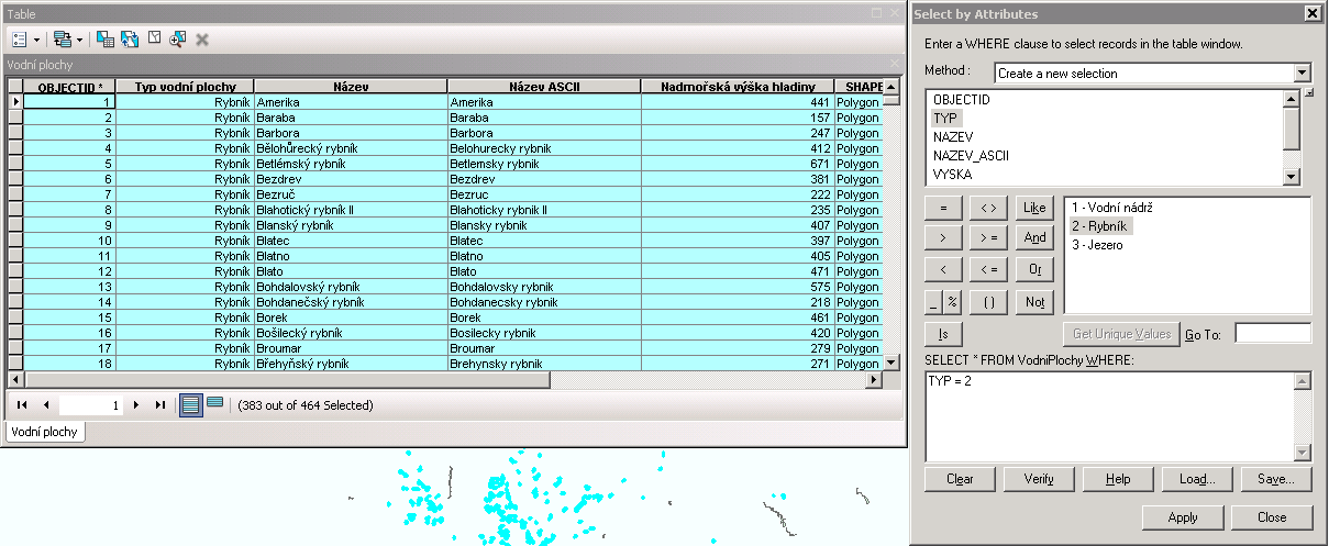
| 30. 9. 2013, 16:06 | Argis-atributy-rybniky.png (soubor) |  |
34 KB | Landa | Řešení první úlohy v ArcGIS {{GIS}} | 1 |
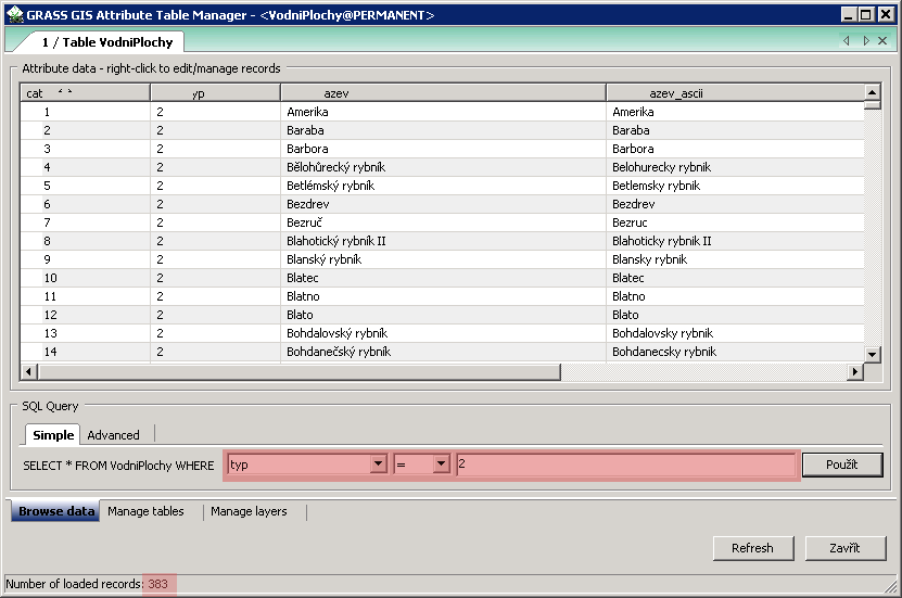
| 1. 10. 2013, 10:03 | Grass-atributy-rybniky.png (soubor) |  |
13 KB | Landa | Řešení první úlohy v systému GRASS {{GRASS}} | 1 |
| 2. 10. 2013, 15:34 | ZOD-cv1-wxgui.png (soubor) |  |
146 KB | Landa | 2 | |
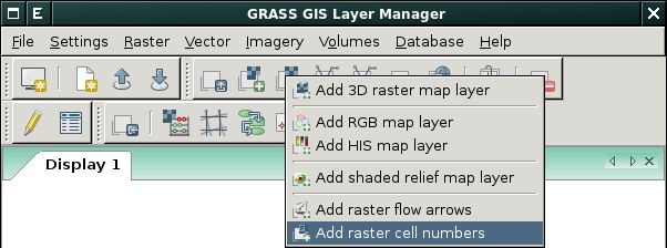
| 2. 10. 2013, 15:55 | Wxgui-d-rast-num.png (soubor) |  |
28 KB | Landa | Spuštění modulu d.rast.num z prostředí wxGUI {{GRASS}} | 1 |
| 3. 10. 2013, 11:33 | Wxgui-mapsets.png (soubor) |  |
18 KB | Landa | Nastavení vyhledávací cesty ve wxGUI {{GRASS}} | 1 |
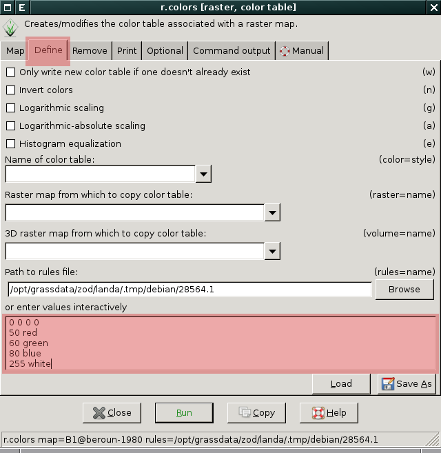
| 7. 10. 2013, 08:38 | Grass-r-colors.png (soubor) |  |
46 KB | Landa | Definice vlastní tabulky barev pomocí modulu r.colors {{GRASS}} | 1 |
| 7. 10. 2013, 08:40 | Grass-colors-dialog.png (soubor) |  |
145 KB | Landa | Interaktivní určení tabulky barev, dialog je dostupný z menu Raster → Manage colors → Manage color rules interactively {{GRASS}} | 1 |